Author - Charles M0OXO

EPC announce – UK DX Contest

ukdxpng300

News from the EPC …

”The European PSK Club has the honour to invite the radio amateurs all over the world to participate in the UK DX BPSK63 Contest 2013. The objective of the contest is to establish as many BPSK63 contacts as possible between radio amateurs around the world and radio amateurs of the United Kingdom of Great Britain and Northern Ireland including all the British Overseas Territories and Crown Dependencies.

Everybody can work everybody for QSO and multiplier credit. Since this year this contest is handled completely by the European PSK Club. We would like to invite you to take part in the contest, the rules and other information can be found at www.eupsk.com website.

It is strictly a BPSK63 contest now, no other modes are allowed so please check the rules as there are other important changes.

Please mark your diaries! The new-style contest starts at 12:00 UTC on Saturday 12th January, 2013 and ends at 11:59 UTC on Sunday 13th January, 2013. All the very best to all of you and see you in the UK DX BPSK63 Contest 2013! – EPC Committee.”


IIØXMAS card preview

FF-II0XMAS

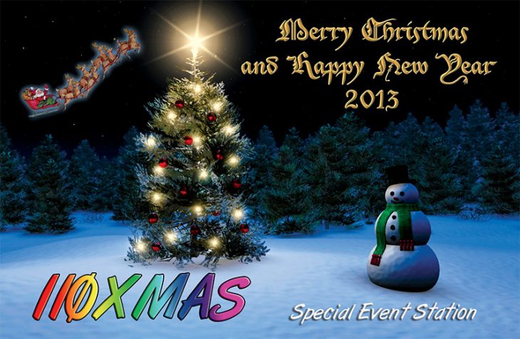
Good news that the Qsl Card for IIØXMAS special event (see Blog entry here) has now been provided by Antonello IZ0VHY.

It will be several weeks before the Qsl Cards arrive so please be patient and keep an eye on this Blog for further updates on this and other stations I manage.

Qsl cards for IIØXMAS and all other stations managed by MØOXO.com can be requested via this address http://www.m0oxo.com/oqrs/ .


IIØXMAS also now Qrv

K800 animated

For the first time this year, Antonello IZ0VHY has organised this special callsign IIØXMAS to celebrate Merry Christmas and to wish everyone a pleasant New Year in 2013.

The station will be operational from 07/12/2012 to 01/01/2013 on 80 – 10M Bands using SSB and Digital Modes.

A special QSL will be printed to celebrate the event which is available via MØOXO OQRS (Direct or Bureau) or if you prefer EQSL then this is available only via IZ0VHY EQSL account.
 
The log will be uploaded on real time on Ham Radio Deluxe HRD and uploads will also be made to excellent clublogClublog Program (click Logo)


Santa Claus OF9X

2012-12-06 151355

Santa lives at the freezing North Pole, leading a harsh but exciting life under the Northern Lights (Aurora Oval). But no one has actually thought about Santa’s specific location – there is no such DXCC entity as North Pole in the world – at least not yet.

Now much to everyone’s delight, Santa’s location is clearly marked on all maps. Santa lives in the Santa Claus region of Finland. That is Lapland, OH9 district, situated north of the Arctic Circle, only a stone’s throw away from the Radio Arcala operating site amid the barren tundra where reindeer run wild. In December, the locals do not see daylight – it is dark all day. As compensation Mother Nature has created a distinctive polar path on 20 meters to North America.

Click the image above to read more about this event.

ZL9HR almost over

zl9hr logo

Latest information suggests that ZL9HR will QRT late Saturday and leave the island on Sunday 9th December, 8am local time.

Campbell Island is a remnant of a dissected volcanic dome. It is 16km by 16km in size, with an area 11 268 ha. Steep cliffs dominate the western shores, while the east coast is broken by several large inlets. Terrain is hilly, with deep gullies and numerous streams.

So time is running out for your chance to secure a contact with ZL9 Campbell Island, New Zealand, the Number 15 on the current DXCC most wanted list.

The ZL9HR log can be found on line courtesy of Clublog.org Click image to be directed to the on-line Log search facility.

2012-12-06 125939

Doomsday – The End Of The World, Special Event

N0D QSL Card

That’s right! The end is finally near!

According to one of the three Mayan Calendars, the end of the world will occur on Dec 21, 2012. To celebrate this literally once in a lifetime event, Special Event Station N0D (Now Zero Days) will be activated for three days. December 20; is a celebration of the end of the world. December 21; the day of destruction, they will be on the air as long as possible. December 22nd, that is a little iffy right now!

More information is available on the Official N0D website, www.nowzerodays.com . You can also e-mail the N0D team at [email protected] with questions or suggestions about Doomsday.

Saturn’s North Pole Vortex

North Pole Vortex

What’s happening at the north pole of Saturn?

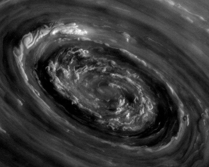
A vortex of strange and complex swirling clouds. The center of this vortex was imaged in unprecedented detail last week by the robotic Cassini spacecraft orbiting Saturn. These clouds lie at the center of the unusual hexagonal cloud system that surrounds the north pole of Saturn.

Saturn’s north pole precessed into sunlight just a few years ago, with Cassini taking only infrared images of the shadowed region previously. The above image is raw and unprocessed and is being prepared for release in 2013.

You can view a ”movie” of this event by clicking the image above.

PTØS summary & video

2012-12-02 132620

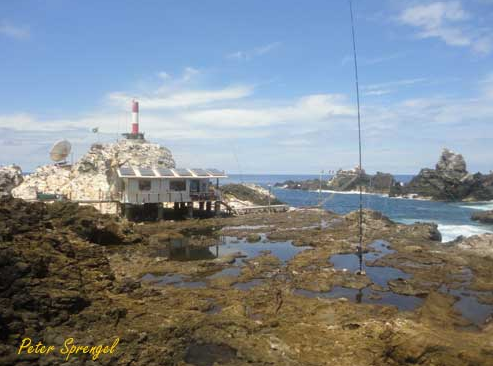
The recent PTØS dxpedition to St Peter & St Paul Rocks by members of the Araucaria DX Group managed to log 44,000 q’s. in 12.5 days of operating.

Broken down into Continents, EU had the most amount of Qso’s logged with 20,386, swiftly followed by NA with 16,207. Asia had 3200 qso’s logged and SA had 3034. The African continent had 729 logged and Oceana 397 qso’s giving a total of 43953 qso’s.

You can read a PDF report about there trip by clicking the link below and also view a YouTube clip by clicking the photograph top left in this Blog entry.

Read PTØS summary PDF here


Qsl requests help Air Ambulance

K800 BBC pictures 062

I would like to give a big thanks to all who requested Qsl Cards over the last 6 months from www.m0oxo.com.

All of the used Postage Stamps on your incoming letters are saved. After several processes and some hard work by other colleagues, the money raised from the ‘sale’ of these stamps are given to a local Charity.

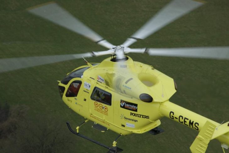
The Charity here is the Yorkshire Air Ambulance (YAA). As a rapid response air emergency service the Charity serves a population of approximately 5 million people across 4 million acres. Our two air ambulances operate from Leeds Bradford International Airport and RAF Topcliffe near Thirsk, and together both air ambulances cover the whole of the Yorkshire region. This service costs £7200 per day to keep these aircraft running and saving lives.

A £50.00 (GBP) cheque was handed to the YAA this week so thanks for all your help. Its not a huge amount in the big scheme of things but every penny raised is a huge help towards running this invaluable service – Thanks for YOUR help!

Read more about the Yorkshire Air Ambulance by clicking this link. (Photo copyright & with kind permission of YAA).


Ice on Mercury – New evidence

2012-11-30 141420

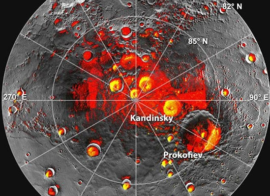
New data from NASA’s MESSENGER spacecraft suggest that there’s enough ice on Mercury to encase the entire US capital !

Given its proximity to the Sun, Mercury would seem to be an unlikely place to find ice. But the tilt of Mercury’s rotational axis is almost zero — less than one degree — so there are pockets at the planet’s poles that never see sunlight. Scientists suggested decades ago that  water ice might be trapped in those shadowed areas at Mercury’s poles. The idea received a boost in 1991, when the Arecibo radio telescope in Puerto Rico detected unusually radar-bright patches at Mercury’s poles, spots that reflected radio waves in the way one would expect if there were water ice. Many of these patches corresponded to the location of large impact craters mapped by the Mariner 10 spacecraft in the 1970s. But researchers weren’t sure if the radar-bright patches detected by Arecibo corresponded to shadowy places in the craters.

The image top left shows Mercury’s north pole. Red denotes areas that are in shadow in all images acquired by MESSENGER to date. (The mapping of shadows is still incomplete near the pole.) Yellow shows the locations of bright polar deposits imaged by Earth-based radar.