The callsign will be on all HF Bands using CW, SSB and Data Modes.
QSL for the event is via MØOXO. Further information available here.
You can find a full list of participating stations here
The callsign will be on all HF Bands using CW, SSB and Data Modes.
QSL for the event is via MØOXO. Further information available here.
You can find a full list of participating stations here
470 Cards to the RSGB Bureau today (07th February 2011) for G4RCG.
625 Cards to the RSGB Bureau today (07th February 2011) for GBØANT.
220 Cards to the RSGB Bureau today (07th February 2011) for MØOXO.
120 Cards Direct for MW0RLJ.
UK-based members of T32C have had several preparatory sessions to clean up and refurbish kit from our previous operations as well as building and testing equipment which we will be using for the first time (for example, new 4-square antennas for both 40 and 30m, and vertical arrays for the high bands, to complement our existing Yagis). Some photos of these activities appear on the website. We have also been getting to know the FT-5000 radios, of which we will have 16 with us on T32, along with Quadra linear amplifiers. Several pallets of gear are now ready to be transferred to the shipping container, which we expect to leave the UK in late February from where it will travel via Singapore to Fiji, arriving in Suva in April or early May, for onward shipping to T32.
A novel development will be the inclusion of a GPS tracker in the container so that we can follow the progress of our kit as it makes its way to the island!
Have a read of the Christmas_Island_DXpedition_Brochure_February_2011, giving much more information about the DXpedition and the island. A copy is included with this bulletin and can be downloaded from the website. While designed primarily to give potential sponsors more information about T32C, we are also mailing to existing sponsors, DX bulletins and others, as we believe it gives everyone some fascinating insights into this major project.
As always, more information will follow in due course. We thank you for your interest in T32C.
Don Field G3XTT, ([email protected]) 3 February 2011
(FSDXA Publicity Officer)
From 4L5A:
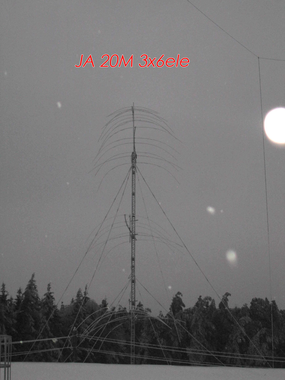
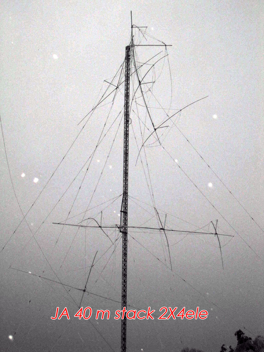
”Folks, don’t take it as a total disaster. Yes the two big antenna, 3 element 80m and a stack of two 4 element 40m, built by RW1AC are completely destroyed. Stack of 3 MAGNUM 620 by “Force 12” is in bad shape too. ALL wire antennas – 80m Delta, ALL beverages, 160m Inv Vee are down. The main calibre weapons built by UA9BA are in tact though.
Rotating 160m dipole (70m long), 4 over 4 80m yagis, a stack of 3 5 element 40m yagis on 84m high free standing tower. A stack of 4 7 element 20m yagis (23m long booms) on another 82 m high free standing tower.  15 and 10m 8 element yagi stacks on 45m high free standing tower. Multi bander (40,20,15,10) with 2 full size 40m elements.
All that is still up and running. In the mean time the ice storm was so bad in the RD3A’s neighbourhood that a 40000 people town of Troitsk is still freezing without electricity for over two days now.” 
These guys are the best at building antenna farms and I am sure they will deal with it head on but boy, to see that when you looked out of your window first thing in the morning.
Lets hope we hear the RD3A Contest station up and on the air again soon, GL guys!
Just a look to the last NOAA’s Space Weather Prediction Center (SWPC) progression chart… really a not encouraging news:
Sunspot count is still lower or forecast levels are still higher?
Thanks to Max IK8LOV for the information http://ik8lov.tumblr.com/
Leo suffered a fractured shoulder and a slight head injury is now recovering in the hospital of Marrakech which has received the first treatment mediche. Non just improve his condition will return to Italy.
Congratulations to Leo lends a healing and a return home soon. The new dxpedition to AF068 will be in september 2011.”
Lets hope Leo and the team have a speedy recovery…..
25 January 2011
The 2001 ‘South Orkney‘ DXpedition is anchored at Signy Island and has begun assembling the camp. We estimate two days will be required to secure our safety and set up stations. Our announced data of 27 January for operations remains intact at this point
73,
The Microlite Penguin Team
The 2011 Microlite Penguins’ South Orkney DXpedition
The South Orkney Islands are a group of islands in the Southern Ocean, about 604 kilometres (375 mi) north-east of the tip of the Antarctic Peninsula.They have a total area of about 620 square kilometres (240 sq mi).The islands have been part of the British Antarctic Territory since 1962 (previously they were a Falkland Islands Dependency), and the British Antarctic Survey operates a base on Signy Island. The islands are also claimed by Argentina as part of the province of Tierra del Fuego, and the Argentine Navy has maintained a permanent base on Laurie Island since 1904. Apart from base personnel, there are no inhabitants.
Last week one of our most active activators found it necessary to cut short his activation in the UK due poor operating by some chasers. Here you will read his account of events and please feel free to add your comments to the discussion at the end of the article:
” Hi all,
Last weekend I was in England to activate 2 nature reserves. Stodmarsh was on the programme for Saturday morning. Very nice nature reserve, well looked after and worth a visit. So far for the good news.
I was very disappointed by the behaviour of the chasers today. It was so bad the I decided to close down after just under 1 hour in which I managed to complete almost 100 contacts. But the patience of some chasers was non existant. Having to work by numbers because of the big pile-up and even then some people did not agree that they had to wait.
When I asked stations with “5” in the callsign and a 9A5 came back someone told him that his call was not valid. Another station worked me from a clubstation with”0” in the call when I called that number. He then asked me for a contact with his home call. Again heavy protest. The protest lasted 30 sec. the QSO 5 sec. So, the moaner prevented me from making 5 further QSO with other stations. It is this kind of behaviour that puts activators off going to WFF’s.
It went from bad to worse with people wanting their number to be called. Then I decided to stop the activation. I still have not sent in the log from this activation and don’t know if I will. This not fun anymore. Therefore I did not do the Sunday activation either.
The chasers should realise that a lot of preparing and money goes into an activation abroad. In my case: ferry crossing, hotel, fuel expenses, mails in which you have to ask permission to activate a WFF. Personally I don’t know if I will continue with WFF, I’ll have to sleep on it. I have now done 50 WFF’s and have seen it deteriorate to very bad behaviour. It is still a hobby and meant to be fun.
In the last year I was fortunate to visit some beautiful reserves and combine this with ham radio; ideal combination, but at the moment I am not completely convinced anymore.
73, Peter ”
Click here to see the DX Code of Conduct
…….See and add your own comments below……
GB0ANT – 360
GB4IPY – 330
GB1TAN – 130
GB1HI – 160
MW0JZE – 75
MØOXO/p (Green Day) – 70
260 Cards processing for various calls, will be mailed 18/01/2011
Well I have been wondering for the last 10 days or so why no-one wants to come back to my CQ calls? Yes, it may be my poor cw but now i think I have found the real reason!
According to the ARRL out of 338 DXCC entities, England is the 5th from the bottom of the most needed. It just makes me want to cry 
(ARRL Least/Most Wanted click Flag to the above to see England basking in 334th place of the most-wanted!)